Hazard Quest coming to Kirkland Nov. 5
Published 6:31 am Thursday, September 15, 2016
Editor’s Note: Hazard Quest, originally scheduled for Oct. 1, has been rescheduled for Nov. 5.
The City of Kirkland Geo Hazards Mapping Team and the University of Washington are partnering for an initiative to identify geographic hazards in the city.
“It’s important to understand the everyday risk in a lived-in community,” said Pattijean Hooper, Kirkland’s emergency manager and a member of the mapping team.
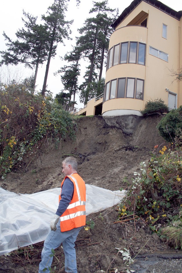
The organizations will host a Hazard Quest for Kirkland residents on Nov. 5. Participants will receive training on what to look for to determine landslide risks, slumping, sloughing and seeps and learn how to use a geo-locator app to create a map of the geographic hazards. The event starts at 9 a.m. at Kirkland City Hall with the half-hour training session. Residents are then encouraged to go out and survey any neighborhood in Kirkland. After the surveying, an optional debriefing and free lunch session will be held back at City Hall.
“I’m very impressed; Kirkland is very proactive in that respect,” Kathy Troost, GeoMapNW director and applied geosciences program coordinator at the University of Washington, said of the event. “It’s important that every citizen knows what the geologic hazards are in the area they live in. … It gives everybody an opportunity to be educated and therefore prepared.”
Troost and her team will review the data collected by residents at the Hazard Quest and then canvas areas of concern alongside members of the city’s mapping team. The GeoMapNW team also has worked with Seattle, Mercer Island and Bellevue to help those cities determine what geological hazards they’re facing.
“It will really magnify the coverage areas we can include in the mapping,” Troost said of the Kirkland citizens assisting in locating problem areas.
If any areas in Kirkland are found to be problematic for landslides, slumping, sloughing or seeps, they will be added to a map. The city currently keeps a database of maps on their website, kirklandwa.gov, through its Enterprise Geographic Information System Program. It can be found under the “Residents” heading near the bottom of the site.
For more information or to register for the Hazard Quest event, visit KirklandCERT.com.